San Francisco is one of the most walkable cities in the United States if you know which streets to take. The hills are real, but they are concentrated in a few places, and long flat corridors run between them. Free SF Tour guides walk the flattest of them every morning. Here is the map in words.
The flat map of San Francisco, in words
- Union Square to Chinatown along Grant Avenue: a gentle rise to the Dragon Gate at Grant and Bush, then a gradual descent to Portsmouth Square;
- The Financial District from Portsmouth Square past the Transamerica Pyramid down to the Embarcadero;
- The whole Embarcadero waterfront from the Ferry Building north to Fisherman’s Wharf and south to the ballpark;
- Market Street from the Embarcadero to the Castro;
- The Marina Green and Crissy Field toward the Golden Gate Bridge;
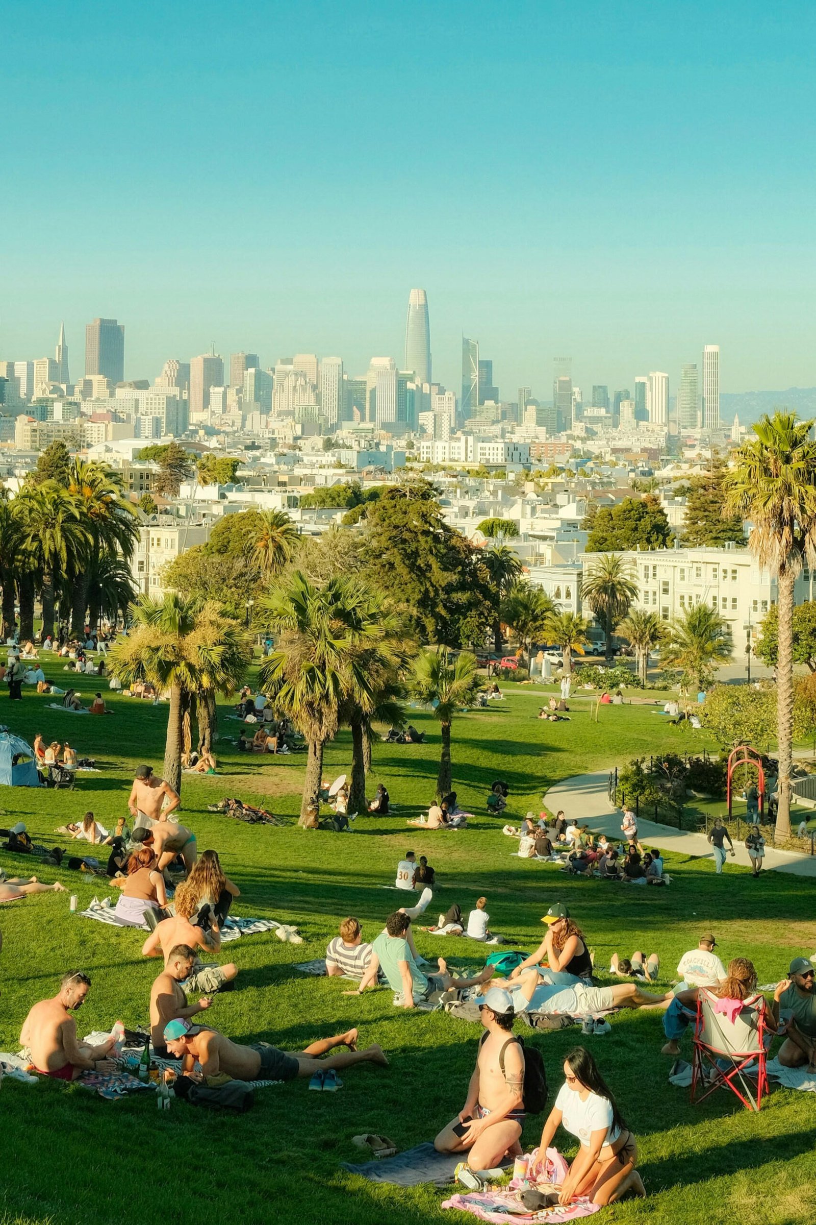
- Valencia Street in the Mission and the flat edges of Dolores Park.
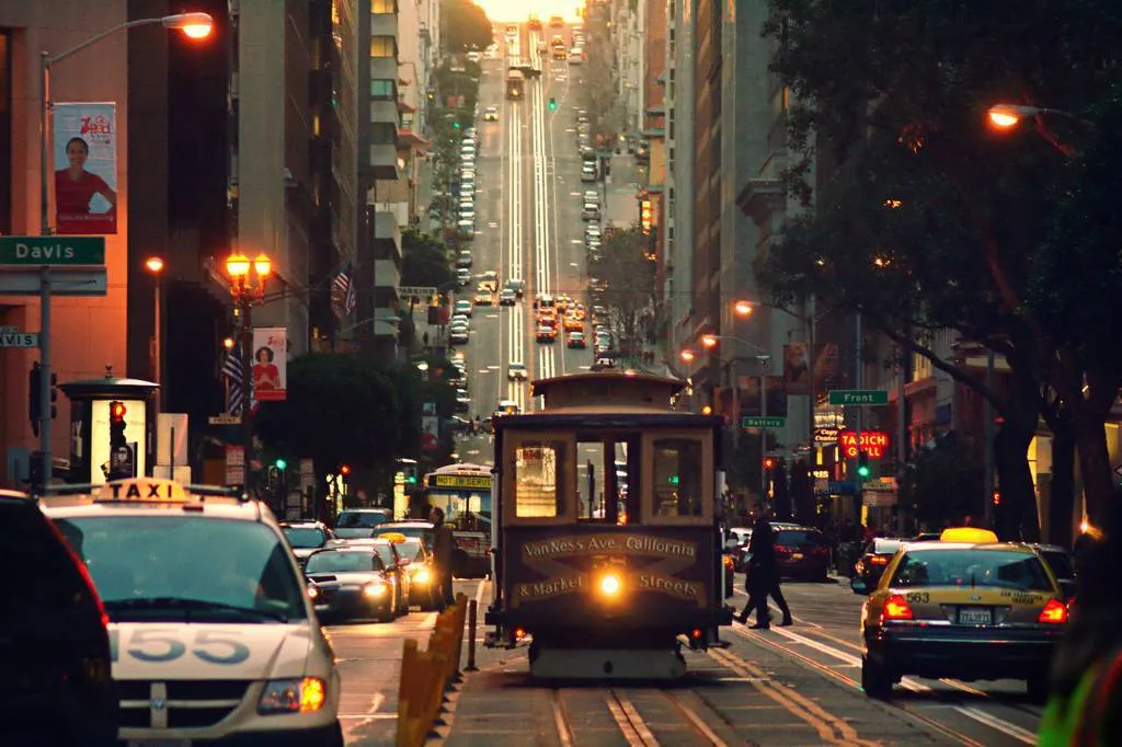
The hills to plan around: Nob Hill (take the California Street or Powell cable car), Russian Hill and Lombard Street (Powell-Hyde cable car), Telegraph Hill and Coit Tower (the 39 bus from Washington Square), Pacific Heights (the 1 California or 22 Fillmore bus), Twin Peaks (bus or taxi, do not walk it).
Key Takeaways
- San Francisco is very walkable if you follow the flat corridors.
- The Embarcadero, Market Street, Grant Avenue through Chinatown and the Marina are level.
- Nob Hill, Russian Hill, Telegraph Hill, Pacific Heights and Twin Peaks are the climbs to plan around with cable cars and buses.
- The morning Free SF Tour is nearly flat.
Is San Francisco walkable despite its hills?
San Francisco has many hills, but the hills are concentrated in certain places. The city offers many flat routes that are easy to walk. The hills do not erase the city’s pedestrian strengths; they just demand route planning.
How do the hills affect walking in San Francisco?
The city has many steep streets that can challenge even fit walkers. For example, a short stretch of Powell Street toward Nob Hill rises sharply over just a few blocks. Walkability changes block by block, so a route that feels easy near the waterfront turns strenuous within minutes.
Where can visitors find gentler walking routes?
Flat terrain concentrates in specific corridors. The Embarcadero, the Marina, and much of Golden Gate Park offer long, level stretches. Free SF Tour runs daily walking tours that help visitors navigate the city’s walkable routes, including neighborhood walks that avoid the steepest grades. For a broader look at San Francisco flat walking routes, the company’s guide to the best walking routes in San Francisco covers neighborhoods like Chinatown, the Mission District, and North Beach.
Citywide walkability varies by block and neighborhood. Visitors who understand San Francisco hills before setting out lose less time to backtracking and avoid exhausting climbs.
How tough is the walk up Nob Hill?
Walking from Powell Street to Grace Cathedral on Nob Hill is a steep climb. The route covers slightly less than four blocks from the Powell Street cable car line to California Street. Travelers researching is san francisco walkable quickly discover that Nob Hill tests even seasoned pedestrians.
The grade intensifies dramatically between Pine and California Streets. That single block stands as the hardest segment of the entire ascent. For visitors used to level terrain, these san francisco hills demand a slower pace and steady determination.
A walker in good health finds the climb perfectly doable. Fitness determines the time required, not distance. The ascent functions as a genuine workout embedded in a sightseeing route.
What is the steepest block climbing Nob Hill from Union Square?
The stretch from Pine Street to California Street presents the toughest grade. Walkers feel the incline shift sharply after crossing Pine. This block forces most pedestrians to pause and catch their breath before reaching the cathedral grounds.
Can an average visitor handle San Francisco’s steep hills on foot?
Healthy individuals manage the climb without issue. Taking it slow converts a punishing slog into a manageable urban hike. Free SF Tour guides point out which blocks to tackle and which to bypass. Their daily expertise covers both san francisco flat walking routes and hill-climbing strategies that spare newcomers unnecessary exhaustion.
The walk ends at Grace Cathedral, a Nob Hill landmark with sweeping city views. Reaching the top rewards visitors with architectural grandeur and a genuine sense of accomplishment. For those unaccustomed to steep urban grades, this short but intense route epitomizes the physical character of San Francisco’s most famous elevation.
Where can I find san francisco flat walking routes?
San Francisco offers several san francisco flat walking routes that avoid the city’s famous steep grades. The 10:00 AM Official Tour of San Francisco follows a 1.8-mile route from Union Square to the Embarcadero: a gentle rise along Grant Avenue to the Dragon Gate, a gradual descent through Chinatown to Portsmouth Square, then level ground past the Transamerica Pyramid to the waterfront. Guests with a bad knee or a stroller manage it comfortably, and anyone who needs a slower pace can just tell the guide at the meeting point.
The tour ends opposite the Ferry Building at the Embarcadero, a flat waterfront area perfect for extended walking. Guests who complete the route can continue along the bay without encountering significant elevation changes. That waterfront stretch rewards walkers with open views and consistent, level terrain.
What makes a walking route truly flat in San Francisco?
A route qualifies as flat when it avoids the city’s hills and maintains a grade easy to walk. Routes hugging the waterfront or cutting through valley neighborhoods typically deliver the gentlest walking experience.
Which neighborhoods offer the easiest walking terrain?
Chinatown contains Waverly Place, a flat, historic street known for its painted balconies and rich cultural history. This vibrant alley sits in the heart of the neighborhood and requires no hill climbing to explore. The Mission District along Valencia Street and the flat edges of Dolores Park are level, and so are the Marina Green and Crissy Field by the bay.
The flattest guided walk in the city
Free SF Tour’s Official Tour of San Francisco runs daily at 10:00 AM in English and 10:30 AM in Spanish; it meets at the corner of Post and Powell streets on the north-west side of Union Square, where the guide holds a white-and-red umbrella that says FREE TOUR; it lasts about 2.5 hours, covers 1.8 miles (3 km) and is nearly flat; the route goes through Union Square, Maiden Lane, Chinatown (Dragon Gate, Golden Gate Fortune Cookie Factory, Ross Alley, Portsmouth Square) and past the Transamerica Pyramid, ending at the Embarcadero opposite the Ferry Building. Arrive 10 to 15 minutes early and reserve a free spot at freesftour.com.
The Night Tour, From Asia to Europe: Chinatown and Little Italy, leaves the Dragon Gate at Grant Avenue and Bush Street daily at 6:00 PM, lasts about 2 hours and covers 1.2 miles, with one gentle climb into North Beach. For the hills themselves, the Free E-Bike Tour leaves Fox Plaza daily at 3:00 PM, rides about 15 miles to 18 landmarks including the Golden Gate Bridge over roughly 4 hours, takes a maximum of 4 riders and has no rental fee; the electric motor flattens every grade.
There is no ticket for any of the three tours; at the end, guests pay the guide what they think the tour was worth. Free SF Tour has run daily since October 2015, has welcomed more than 80,000 guests and has three times been voted the best free tour in the USA.
FAQ
Is San Francisco walkable without climbing hills?
Yes, if you stick to the waterfront, Market Street and the Grant Avenue corridor.
Where are the flattest walking routes in San Francisco?
The Embarcadero, Market Street, Grant Avenue through Chinatown, the Marina Green and Crissy Field, Valencia Street.
Is the Free SF Tour hilly?
No, it is nearly flat, 1.8 miles in about 2.5 hours, from Post and Powell to the Embarcadero opposite the Ferry Building.
Conclusion
The hills are the postcard, the flat corridors are how you actually get around; walk the level routes, ride the cable cars and buses up the hills, and start with the nearly flat morning walk from Union Square.